Synth’s powerful platform brings together vast data sets from multiple sources to create the most comprehensive single view of evolving geographic and environmental situations.
Analyse data faster and easier to better map your responses, plan your next moves, and truly understand the world around you.
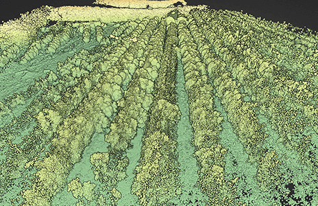
Process large volumes of data from a range of sources, producing detailed, multi-dimensional visualisations almost instantly.
Secure and simple
Log in to a protected, cloud-based platform right from your browser, with no risky downloads.
Real-time annotations
Mark-up geospatial maps easily and efficiently, and share your insights with others in just a few clicks.
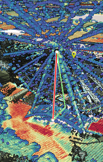
Easy measurement
Draw on accurate, in-map tools to capture complex measurements and better plan actions.
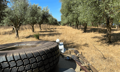
Mobile access
Use Synth Maps from your mobile device anywhere, at any time, without losing valuable functionality.
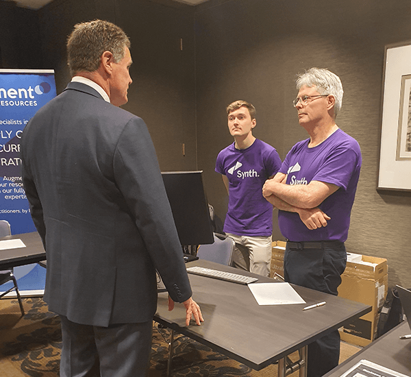
Specialist support
Lean on our Australian team of experts when you have a question or need assistance.
Social proof
Don’t just take our word for it
Lorem ipsum dolor sit amet, consectetur adipiscing elit, sed do eiusmod tempor incididunt ut labore et dolore magna.
Leyla Boyer, CEOSpatial
Ut enim ad minim veniam, quis nostrud exercitation ullamco laboris nisi. Sed ut perspiciatis unde omnis iste natus.
Shiv Krause, Marketing DirectorPretzellab
Excepteur sint occaecat cupidatat non proident, sunt in culpa qui officia deserunt mollit anim id est laborum. Sed ut perspiciatis.
Brendon Hall, ManagerForethought
Previous
Next
Industry & Research Partners
about us
The team behind Synth Maps
Synth is the embodiment of our founders’ fascination with our evolving world, and their intrigue at the possibility of bringing those changes to life in a visual and truly useful way.
Every second, minute and hour, our planet is changing around us, as is the way it is able to support and nurture the people, flora and fauna that live on it.
Our curious team of developers want to help us better understand these fascinating changes – why they’ve occurred and what will happen next.
Come meet our friendly team of geospatial architects.
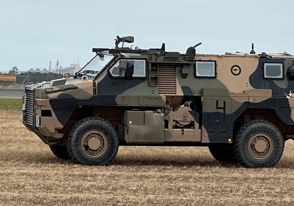
Whether responding to natural disasters in the neighbouring Pacific Islands or building invaluable infrastructure in the war-torn parts of the Middle East, Australia’s soldiers rely on accurate data and clear visualisation tools to effectively plan operations and minimise casualties.
Synth Maps enables vast volumes of data from sources including drones, hand-held and vehicle-mounted devices, photography, and 3D models to be layered into one multi-dimensional map. Using the platform from a mobile device, defence teams can quickly assess areas of operation to plan travel routes, all without leaving their vehicle.
Over recent decades, as the world has changed around us and we have seen more floods, fires, droughts, and storms, human beings have identified a need to adapt, evolve, and preserve to work in partnership with our planet.
By bringing together an array of data from the past and the present – changes in landscape, precipitation, pollution levels, soil – in specific geographic locations, we can reduce our impact on nature and its often devastating impact on us.