Synth Maps empowers scientists, engineers, civil defence authorities, and horticulturalists with a suite of advanced, yet accessible tools for mapping and analysing visual data.
Showcase
See how Synth Maps works
Designed to be intuitive and easy, once you log into Synth, getting started is just a matter of uploading and layering your data, to output a single, detailed geographic map.
Collect
Data collected from a variety of sources.
Upload
Uploaded quickly and easily to Synth Maps.
Layer
Layered to deliver a comprehensive ‘big’ picture.
Present
Presented on desktop or mobile for access anywhere.
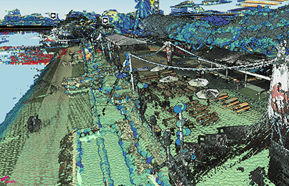
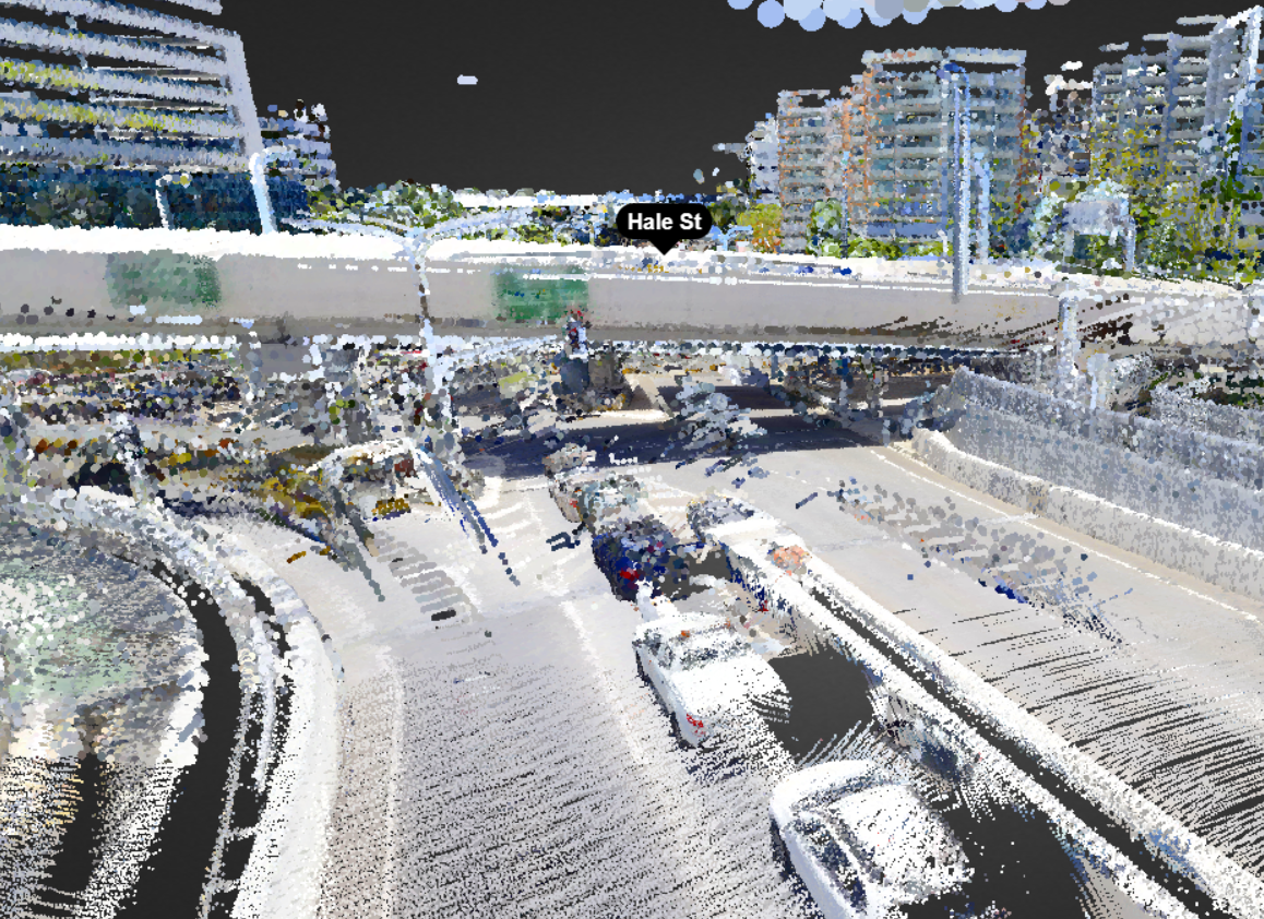
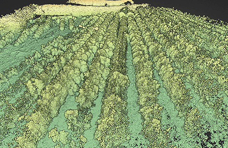
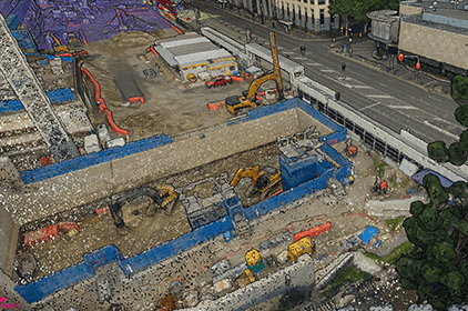
Achieving a truly comprehensive view of a geographical situation means being able to assesses it from a variety of angles, to better understand all the factors that contribute to it, and all the impacts it may have.
Giving you the ability to upload and process large volumes of three-dimensional data from a range of sources – fast – Synth Maps provides a multi-dimensional representation of your scenario, enabling you to see what has occurred, and more accurately plan and prepare for what will occur in the future.
Ideal for civil defence operations that need to roll out without delay, environmental research and agricultural planning, Synth Maps increases the speed and accuracy of critical decision making.
Feature spotlight
Secure and simple access
Being able to assess a situation while you’re in it is absolutely crucial in many environmental and defence scenarios, and takes geospatial awareness to a new level.
Available on desktop and mobile devices, with no download requirement, Synth Maps is cloud-based and designed to be accessible no matter where you are.
Focused on providing a secure and safe connection to multi-layered visual data, our platform ensures insights are just a quick tap or two away, even when you’re in the field.
Quote
Client testimonial
Lorem ipsum dolor sit amet, consectetur adipiscing elit, sed do eiusmod tempor incididunt ut labore et dolore magna.
Leyla Boyer, CEOSpatial
Feature spotlight
Real-time collaboration
It’s not enough to be able to see your data – you and your colleagues need to be able to interact with it together, so you can share insights and expertise.
Offering built-in, intuitive tools for marking up your geospatial maps and accurate measurements, you will be able to communicate efficiently and effectively with trusted key stakeholders all over the world.
Not just a data and mapping tool, Synth Maps is set to become a complete collaboration platform, that connects the dots between analysis and action.
Feature spotlight
Specialist support
Designed for the everyday user, not the computer genius or CAD extraordinaire, Synth Maps offers intuitive upload and processing, and features and functions that just make sense.
Get started and become a pro with no training needed!
Supported by a team of friendly and passionate experts, even complex projects are made simple with Synth Maps.